Manaslu Trek Map: Navigate any path Like a Pro with Insider Tips
8 Aug 2024 Chandra Gurung
Zoom in with your fingertips! What comes to mind when you want to navigate the Manaslu Trek with the map at your convenience?
Manaslu Trek Map and an experienced guide, right? Here, our team not only gives you access to a handy map but blends your exploration with technology just to make your adventure an ever-recalling one.
Walking to the sun-kissed glaciers, the Ultimate Manaslu Trek Map aids your navigation process. Are you ready to check switchbacks and investigate your route with our Trek map?
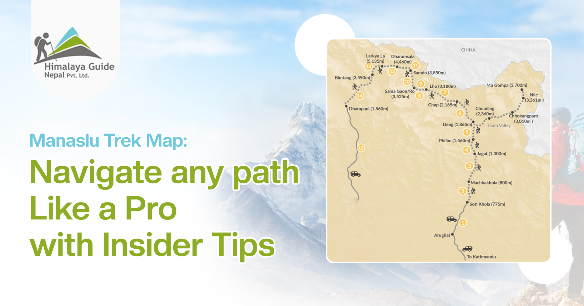
Understanding the Manaslu Trekking Map
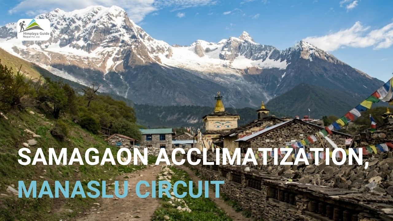
Manaslu Circuit Trekking is a 177-kilometer route embedded in Nepal’s Himalayan trail. The rugged landscapes do push you to go beyond the personal challenges and stroll through the water sources and serene sanctuaries.
The journey is all about knowing the essential navigation tools, elevation gains, and keeping your feet active. Throughout the challenging Manaslu Circuit Trek days, you traverse a remote wilderness in the Himalayas.
Things get tough when the crisp air starts getting thinner. But you can avoid detours and safely integrate into the rhythms of mountain footprints with our Manaslu Circuit Trek Map.

The Manaslu experience transcends mere navigation. Here is to embracing the challenge, conquering miles of thrills and excitement, and rushing to meet the boundless horizon on the Manaslu expedition.
More than just a Trekking Map
More than just footsteps, the allure of venturing off-beaten paths and rustic landscapes is something else. As your lungs are just being introduced to the crisp mountain air, you gain the spirit of evaluation and merely understand the story of each switchback.
Towards the destination, you can form friendships, share stories, and embark on an unforgettable adventure utilizing the information on the map. You can now explore the secluded valleys with our trekking maps at your fingertips when you browse free, downloadable trekking maps on our website.
Do you know? GPS devices have just revolutionized the navigation process. The whole concept of wandering in a new place and avoiding failure in trekking is safer these days. What we suggest is to navigate the wilderness with caution. For that, we also introduced our Trekking Map, which keeps you safe from potential hazards in the lap of the Himalayas.
Why use the Manaslu Trek Map in day-to-day navigation?
Manaslu circuit days are not complete without the map. It is because the map is truly a comprehensive guide that helps you understand the terrain and pre-plan the entire journey.
The map helps trekkers ascend and descend safely in the unpredictable circumstances on the route. Even crossing the suspension bridge of the Budhi Gandaki River and tracking the dense rhododendron forests in the Manaslu Conservation Area has become more convenient.
The valuable insights from the Manaslu Trek map helps you tackle potential hazards and challenges in the Manaslu region. Besides, it is responsible for making your trekking activities more manageable on forested sections and steep climbs.
With navigation tools like trekking maps and compasses, one can conquer high-altitude passes, like the Larkya Pass. Loose scree slopes and steep drop-offs can be life-threatening when you lack impromptu guidance. So, better avoid the slippery trails and easily navigate the avalanches and safe side, when you can access a detailed Trekking Map right in your hand.

Benefits of the Manaslu Trekking Map
You can nail the trip when you have the map to the most awaited adventure. Beyond the waves of the meadows, you can embrace the symphony of nature. Your efforts to conquer glaciers can simply triumph as we have your back. Fear not, as we present a tailored trekking map for your Manaslu adventure.
Confidence in trekking
Whenever you have a digital map, you can simply zoom in and navigate the trail’s ups and downs. You get confidence in choosing the right path and trails, identifying the potential risks and alternatives of the rocky ascents, and hidden shortcuts, and thereby, unlock a whole new adventure with confidence.
Navigate safely
Mountains can get unpredictable, it is when the trekking map comes to the rescue. It gives you an advantage to navigate safely in the wildflowers, secluded trails, and breathtaking gorges. Simply, it helps you track the avalanches and risk aspects and move past them to enjoy a ruthless experience on the rustic Himalayan trail.
Pre-trek planning
If you visualize the entire journey with a virtual map, you can get an idea of the overall distance, elevation gains, and landmarks. By identifying what your realistic daily trek will be like, you can trace your stops and destinations based on the map’s information. So, go searching for the Manaslu trekking map that just interprets your whole journey.
Adhere to Guidebook
When you have the Manaslu Circuit trek map in your hands, you can understand what is truly planned in your guidebook. The map introduces you to challenges, additional information on history, landmark descriptions, and cultural insights into the Manaslu region. And if you take our Manaslu guidebook along with the map, you can protect yourself from unexpected detours.

Navigating Manaslu: Essential Maps and Backup Options
You need to choose the right tools just before your Manaslu Circuit Trek begins. Incorporating maps, compasses, and a blend of technology is important for you to navigate Manaslu with confidence. So, what are the essentials of a map?
Scale and coverage
Whenever considering choosing a Manaslu Circuit Trek map, you need to see if that particular route covers your entire route. An in-depth and broader overview of the landscape is required to explore the Manaslu trek.
Readability
Easy-to-read text and symbols are something you ought to look at on the Manaslu Trekking map. For effortless interpretation of the Maps, it must contain all the essential guiding tactics and must possess clarity in instructions regarding the trek coverage.
Reliability
A map can be a reliable companion to understand the elevation, markings, clear symbols, and the journey elements in brief. The Manaslu Trek Map also incorporates side trails and alternative routes which makes it convenient to accurately pinpoint steep climbs, switchbacks, and elevation markings.
Guide Practically
A map with practical guidance is among the choices of users. It shall comprehend the examples, clear symbols, and visual diagrams making the study easier. When all these essential criteria are met, the comprehensive navigation facilitates planning and even responds to some unprecedented changes in your adventurous trail.
Emergency Backups
Maps and compasses are effective navigation tools, however, their limitations cannot be denied. Digital Maps are reliable only when you have a personalized emergency backup, waterproof GPS, and offline recording options which makes navigation possible in extreme climatic situations.
Conclusion
Adventure often awaits those who swing for the thrill, take on challenges, and navigate their way safely. Every step towards the Manaslu Circuit adventure can now be mapped. Campsites, teahouses, and ancient monasteries their precise location is updated on the map. Your next stop is merely beautiful and safe when you know exactly what you want in your trekking avenue.
Just before you precisely plan the trekking routes have a look at a map that guides you to the raw beauty and vibrant festivals of Manaslu. Better not get confused on what you ought to do and skip on passing through the off-beaten trails, and approaching a step closer to the viewpoint of killer mountain, Mt Manaslu.
Even when you have a trusted trekking guide, navigation can be challenging. The more precise the Manaslu Trek map is about the twists and turns of the routes, the more reliable it is to keep you safe.
Chandra Gurung