Around Manaslu Trek, you will get the most amazing experience. This is the best trekking destination after driving the road in the Annapurna circuit because the Manaslu trekking route is very peaceful to walk because there is no driving road. So, there are many side trips when you are on a Manaslu circuit trek. When you are on this trip, our office staff will take you to this side area if you have time.
Kal Tal 3650M
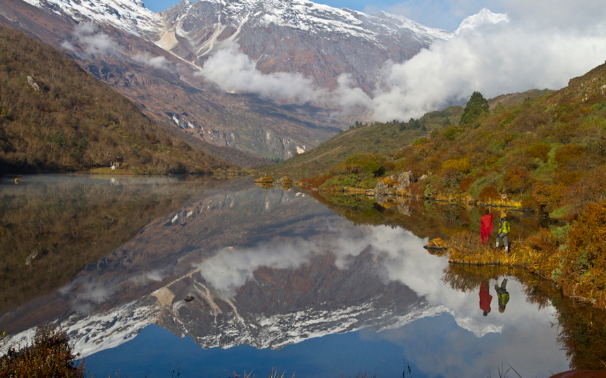
We recommend a side trip to Kal Tal; this lake is not a common way to the Manaslu circuit trek but a side part so you can manage one day to spend Prok village and the side trip to Kal Tal. This is a mountain lake at an altitude of 3685 meters. It takes about 5-6 hours to Round Trip Lake from the village of Prok.
The mountain scenery from the lake is superb, but the effort is worth it only in clear weather. In early autumn and late spring, clouds cover the mountains even early in the morning, so plan accordingly before you leave Kathmandu.
Hinang Gompa 3120M
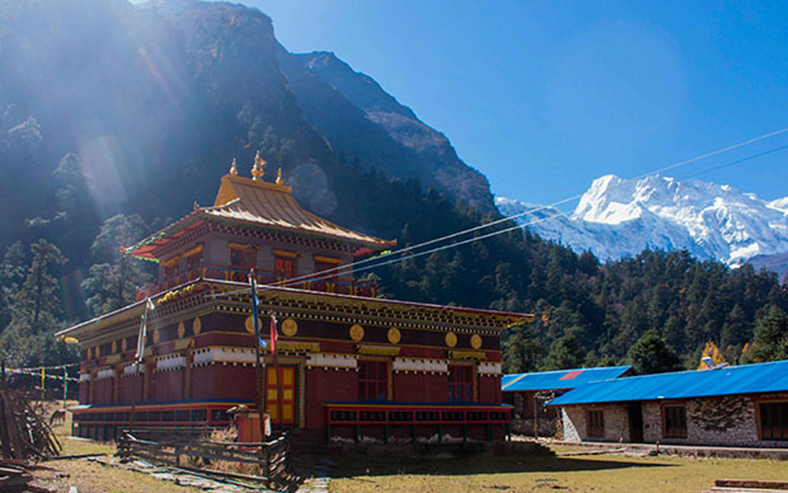
Manaslu trek route goes through Lihi phedi so we should walk to Lihi village to go Hinang Gompa. It takes 1 hour to walk from Lihi village, ascends to Hinang Khola, and go to the large Hinang Gompa. When you are there, monks will come as their culture, and there is a standard room and basic food, so if you prefer to spend a night there.
If you continue ascending the Himal Chuli range, you can see spectacular Mountain views and continue to visit the Hinang glacier. Taking a local guide that knows the area and the glacier is highly recommended. We highly suggest you go to Hinang Glacier and hire a local guide from the village.
One of the most stunning gompas on the Manaslu Circuit Trek is, without a doubt, the Hinang gompa, which is situated in the town of Hinang. It is surrounded by a yellow pine forest and Mount Himalchuli in the background. After 20 minutes, the Lihi settlement and the road leading to this gompa part ways. You can travel up to the Hinang glacier from the gumba.
The main idol in the gumba is Gautam Buddha; Guru Rinpoche (Padmasambhava) is on the right, and Guru Karmapa is on the left. It is also a lama school, and in the winter, its pupils travel to Namobuddha Gumba in Kathmandu. This monastery was constructed around ten years ago, and Khenchen Trrangu Rinpoche is the chief lama in charge of maintaining the gompa.
Punggen Gompa 4245M
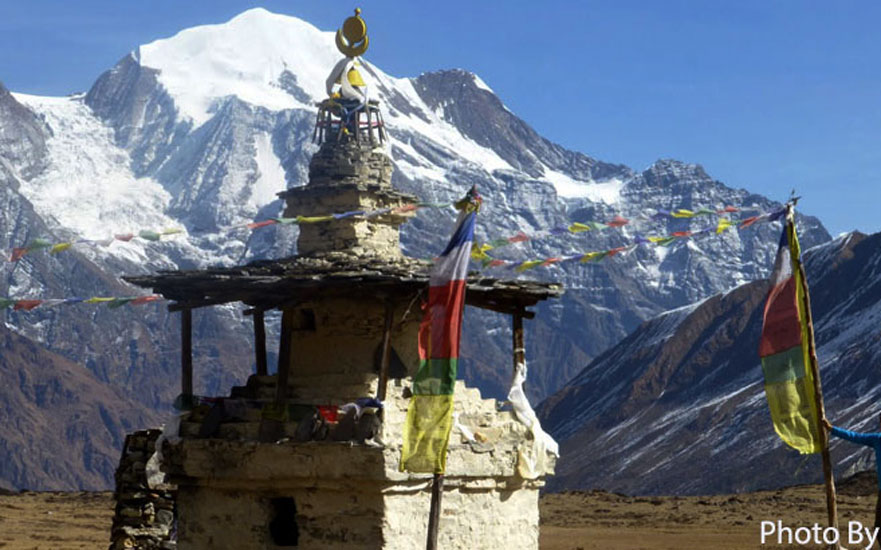
Punggen Gompa is a day trip that starts on a trail branch between Shyala and Samagaon. It takes about an hour to reach a Yak pasture area and an additional one and a half hours to reach the Punggen Gompa; this place is located at the end of a vast green plateau surrounded by dramatic mountain scenery.
This is one of the best places to view Mount Manaslu from the mountain valley, but again, the effort is worth it only on a clear day. The Gompa includes a small prayer hall and some monk dormitories built into the mountain. There are no accommodation facilities here, but it looks like an attractive place for camping. Morning views from here will probably be fantastic.
Birendra Tal (Lake) 3643 M
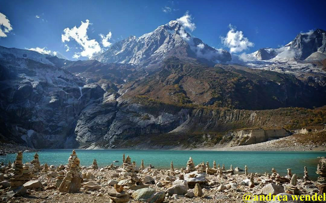
Birendra Tal (lake) is a turquoise lake at the foot of the Manaslu ice sheet and a day hike from Sama Gaon. It tends to become to by 45 minutes turn from Sama Gaon. Those who like to wash and shower in removed waters will think it’s agreeable to plunge in its nippy ice water. The lake can be visited in transit from Sama Gaon to Samdo, as it is a generally short preoccupation from the primary trail.
Manaslu Base Camp 4756M
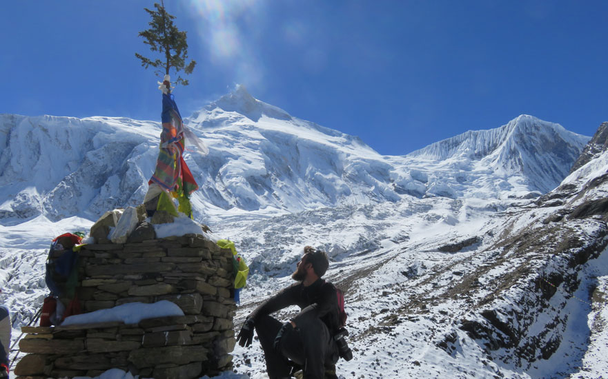
Manaslu base camp is a starting point for all Sherpa, guides, and guests; who are preparing for the Mt. Manaslu expedition and acclimatized there to make it easy for the summit. Mainly, two seasons for the trip, so this time base camp looks like a festival place due to colorful tents and many people of expedition members.
We move from Samagaon, which takes around 4-5 hours, to MBC. The trail has a short beginning in the timberland that winds up uncovered on the precarious incline above Samagaon north of the fantastic Manaslu ice sheet. As you gain elevation, the view turns out to be increasingly wild – the adjacent ice sheet, the turquoise lake underneath, and mountains to the extent the eye can see.
The last piece of the trip is the steepest on a tricky trail on a limited moraine. Next to the experience of seeing the camp movement and meeting climbers in expedition time only, the encompassing Mountain View is amazing. Even though some ice sheets put together water sources concerning the way, convey enough water with you. The slide to Samagaon takes around 3 hours.
Tibetan Border – Rui La Pass 4998M
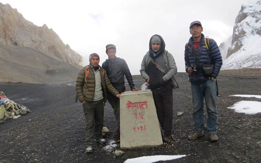
Day hike from Samdo, there are two choices to get to the Tibetan fringe. The alternative is seeing the view from Lajyung Bhanjyang, a go at 5098 meters east of Samdo. Local people did not prescribe this choice as it isn’t generally utilized, and the trail isn’t clear (Yaks rule these slopes and imprint various paths there). Alternative two is the “fundamental street to Tibet,” which means the primary exchange course to Tibet that experiences Rui La go at 4998 meters north of Samdo. The closest Tibetan town is just a multi-day stroll through this course, and a motorable street on the Tibetan side is a two days walk. We picked this choice as local people suggested it is a constantly utilized trail and guaranteed it tends to be done on long vacationers strolling a day.
When trekking the Manaslu circuit, the Rui La pass has become a popular tourist destination and is accessible via a day trip from Larkya Bazar. Going with a local guide is advised because the Rui La Pass trail from Larkya Bazar is not adequately defined. After crossing the river, the way climbs steeply on a pebble trail to the border, with the first half of the route being relatively easy across a grassy meadow. The barrier that separates Nepal from Tibet is located at Rui La. The Rui La offers a grand mountain view that includes the Fukang Glacier, Nepal, and Tibet. It is sager to travel with enough food and water as there is no inn or tea shop along the route.
You begin by going north from Samdo as though you are going to Dharamshala: crossing the Athahra Saya Khola and moving from the opposite side. In any case, rather than going west towards Dharamshala, you proceed north along the western side of the Athahra Saya Khola. The trail climbs step by step along the Athahra Saya Khola and, at that point, drops delicately towards the stream bed, crossing a side waterway on a wooden scaffold. It, at that point, climbs again and goes adjacent to the stream on its western side. Following 3 hours stroll from Samdo, the Athahra Saya Khola turns west. On this point, there is a little wooden extension, and on the opposite side of it, a reasonable incline that prompts a removed mountain pass. Cross the scaffold and start to jump on the rise.
The trail may appear vague as a few Yak trails are going up. However, as you climb unmistakably, your route is up. Moving to the highest point of the Rui La, at 4998, takes 2 hours. En route, there are excellent sights of Manaslu out yonder just as the Hindu and Fukang icy masses are simply behind you as you climb. The Rui La pass is a “work of art,” “U” formed mountain pass. Petition banners mark the pass, and an outskirt stone denotes the fringe among Nepal and “Dzong Who” – China. Various mountain reaches can see on the Tibetan side, and on the off chance that you are quiet enough, hold back to see a Yak parade crossing the go to bring merchandise into Nepal. The route back to Samdo took us 4 hours. Begin early and take enough drinking water with you.
Ponker Lake 4200M
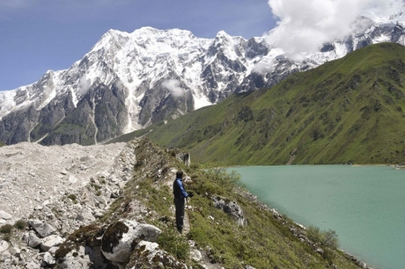
Ponker lake is beside the Bhimthang; this lake is made from Himlung and the glacier of the other many mountains. When you descend from Larkya Pass, you can see a very clear lake, and if you have a day’s rest in Bhimthang, you would better visit this Tal.
Moreover, Ponker Lake Trip is the most exciting trek in Nepal and the most unappreciated trekking location to date. This wonderfully preserved lake has only recently attracted a small following and received scant global acclaim.
The location continues to astound hikers with its breathtaking outlook, varied landscape, and wilderness. With the soft mountains caressing each of its guests, just the lake celebrates its beauty. Imagine the wonderful welcome one will experience as they stroll through Bimthang in the Manaslu region.
Ponker Lake Trek hasn’t yet succeeded in attracting a steady stream of both domestic and foreign tourists. However yet, the Manaslu Conservation Area Project occasionally had a visitor to the location.
Links:-
Annapurna Trek Everest Trek Peak Climbing Langtang Trek Tour in Nepal

